
|
|
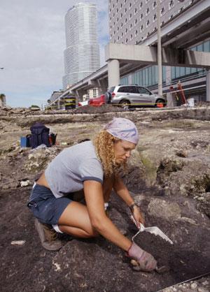
In a few days of intensive work, the research team was able to accomplish a more in depth GPR survey of this key Miami area than has been done to date, producing much excitement in the area as to what might be possible in the future.
A June 22, 2003 article in the Miami Herald best describes the excitement this project generated, as can be seen here on the Miami Herald Website. This is one of the first instances in the South Florida area where such a high level of expertise in geophysics has been used with disciplined archaeological methodology.
|
This combination of state-of-the-art geophysical support applied to archaeological site support is in fact the mission statement for the current direction for Mnemotrix Systems, Inc., which has twenty years of experience in Information Technology applications which it is applying to the field of remote sensing. Mnemotrix's technology applications profile includes the delivery of Ground Penetrating Radar (GPR) and other remote sensing survey services.
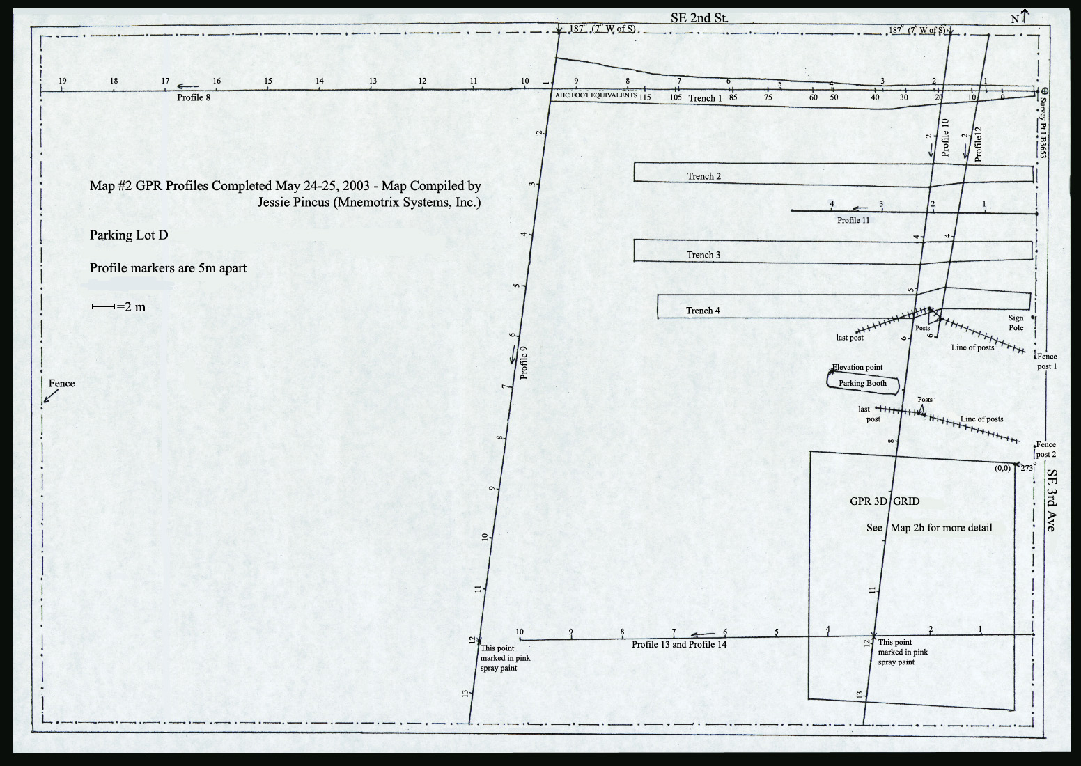
Mapping of the area done by Jessie Pincus of Mnemotrix Systems, Inc., who is a geology and archaeology graduate of the University of Miami, shows the areas where a Mnemotrix 200 MHz antenna was used to obtain in-depth survey acquisition lines of the area.
|
 Click for Larger View
|
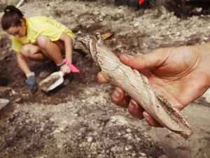
Initial follow-up study from the GPR survey helped to locate the old Miami shoreline. By focusing attentions in this area, the archaeologists were able to more rapidly locate an area of ancient habitat, and therefore knew where to look to locate artifacts which are too small to be revealed directly through the use of GPR technology alone.
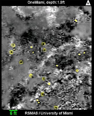
By completing an intensive collection of GPR survey lines, very close together, it is possible to create an animated sequence of the depth slices which can be viewed in movie form, one of the labor-intensive but highly valuable post-processing services which Mnemotrix provides. You can click here to see the movie created by Dr. Grasmueck after the April study, which was posted June 20, 2003. This movie, a composite of ground-penetrating radar images produced by University of Miami geophysicist Mark Grasmueck, shows a 66-by-77-foot section of the downtown Miami archaeological site. The 24-second movie tracks subterranean features to a depth of approximately 6.5 feet, and can be seen here courtesy of the RSMAS facilities.
Mnemotrix Systems Inc. personnel are currently engaged in post-processing a huge amount of GPR signal data collected in June 2003 at key archaeological sites in the Middle East. Animated 3D "movies" and full reports can be seen on this website as they become available, at http://www.mnemotrix.com/geo/#post.
See other 3D animations on our website at movie.html .