Tell es-Safi, Israel, Summer 2004
Tracking the Trench
Grids 9, 10, 11:
Click for GPS Coordinates
Click for Animation
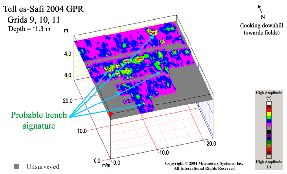
The next practical area beneath the hilltop where the siege trench had been
excavated in previous seasons was chosen for Grids 9, 10, and 11. Areas 9
and 10 at the top of the
hill towards the south were between boulders
and barely accessible, but we were able to acquire some transects.
This allowed for better plotting of the direction the trench seems to be taking
as it wends its way down the hill. Grid 11 was steep but accessible,
so we were able to execute interlocking grids in both directions (E/W and N/S),
which captured the signature of the trench in an effective
high resolution manner.
