


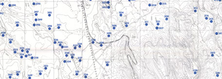
Geographical Information System (GIS) Support Mnemotrix Systems, Inc., builds and hosts Intelligent Agent software applications using its own software development engines with accompanying server and bandwidth afforded by a T3 backbone. We have built and integrated this technology with advanced GIS integration to create a Smart GeoData-Referencing System from which we can host numerous applications to clients globally. In Israel we specialized in state-of-the-art applications in High Resolution Archaeology and Agriculture where it interacts with city and urban planning, using ArcIMS to display interactive layers of Historical Time Periods. This same approach can be applied to any Open-Area Planning and Analysis System, and Geological, Environmental and Natural Resources Planning and Management, including Oil Field Management, Large-Scale Agricultural Land and Community Development, Logistical Planning and Facilities Distribution.
More Info on Mnemotrix GIS Support Services
Smart Geo-Referencing Over the last 20 years we have built many types of "Intelligent Agent" hosted databases for clients worldwide. Based on the idea of corporate and institutional Legacy Databases these are complex "Smart" databases which embody certain artificial intelligence qualities. We have now merged the technology of Intelligent Agent software with GIS to create a paradigm shift in GeoReferencing technology and spatial analysis.
Let us clarify a few technical terms.
are custom built computer software systems which in our case help to automate the human cognitive process of correlating and matching groups of information to one another, based on various criteria as designated by a researcher. These programs can search across large amounts of textual information and automatically link data based on more than traditional terms or key words or synonyms. These programs can correlate chunks of information conceptually or thematically, regardless of whether the data contains any of the initial words used by the researcher to compel the computer to search. These profiles can be edited based on what the researcher learns and can be made "smarter" and "smarter" over time. These types of database and search technologies have been for many years in a league of their own. Our approach makes use of an equivalence engine using a semantic lattice driven by algorithms which simulate through lexical set manipulation parallel pattern matching funtionality based on synonym and metonym association. Searches are speedily performed and produce lateral, intuitive results across categories, between departments, along thematic and conceptual lines in a way hitherto unavailable by others. Mostly compelled to strategic applications for industry and science, they represent a new leading edge in information science and data management. You can see some of our applications at http://www.avdat.org and at http://www.mnemotrix.com/adasr.
Applications:
These technological capabilities are at the core of Mnemotrix Systems, Inc's portfolio of services. We find this field particularly exciting since one of the big drivers of technology in this new century is EOS (Earth Observation Systems), replacing "defense", the technology driver of the 20th century.The applications are endless in vastly diverse fields, including large-scale land management, oil field management and updating, utility deployment and documentation, community development, architectural design and city planning, agricultural research, planning and engineering, all kinds of civil engineering and planning projects, security and emergency planning for military, police and fire, archaeological site management, cultural resource management, environmental engineering and resource planning, to all sorts of internal system applications such as civil defense emergency handling systems, interior building planning and design, social dynamic modeling, catastrophic weather and disease outbreak management, logistical support of all types, many types of monitoring systems, and an almost infinite number of contingency planning type needs.